
MASSA [MASSART, MASSAERT], ISAAC.
Baptized October 7, 1586 in Haarlem, died 1643.
Dutch cartographer and traveller to Moscow.
Isaac Abrahamszoon Massa was a Dutch grain trader, traveller and diplomat, the envoy to Muscovy, author of memoirs witnessing the Time of Troubles and the maps of Eastern Europe and Siberia. Massa's experience in and knowledge of Muscovy transformed him into a Dutch 'Kremlinologist.' The Isaac Massa Foundation in Groningen aims to stimulate scientific and cultural contacts between the Russian Federation and the Netherlands.
Isaac Massa was born in a wealthy silk merchant's family that relocated from Liege to Haarlem before his birth. His ancestors could have been Italian huguenots who fled their homeland in the beginning of the Reformation. The family surname was also known as Massart, Massaert.
In 1601 Isaac left Haarlem for Moscow to assist the family trade. Isaac has been witness to the second half of Boris Godunov's reign that evolved into a civil war now known as the Time of Troubles. He survived the capture of Moscow by False Dmitriy I and left Russi...
Bland arbeten.
Plans of Moscow 1610, 1618;
N. Russia 1612 and
South Russia, used by Blaeu & Jansson.
Tooley.
1795-1876. Född och död i Hafslo.
Norsk officer och historiker. Blev 1811 officer och strax efter anställd som mättekniker vid 'Den Geografiske Opmaaling'. 1815-16 deltog han vid utarbetandet av den norska delen av den stora generalkartan över den skandinaviska halvön, utgiven 1826 av C.G. Forsell (se denne). Under ĺren 1817-43 var han lärare i kalligrafi och teckning vid Krigsskolan i Norge. 1825 utnämnd till kapten i armen men blev 1845 tvungen att ta avsked pĺ grund av försämrad syn. Tillsammans med N.A. Ramm (se denne) utarbetade han de första länskartorna i Norge. - Munthe hade starka historiska intressen och bedrev omfattande studier av det gamla Norges geografi och stadsnamn, samt medeltidens släkthistoria. Författare av en rad avhandlingar. 1832 var han med om att stifta 'Samfundet for det Norske Folks Sprog og Historie'. Medlem av Vetenskapsakademin i Trondheim.
N. biogr. leks. - de Seue.
1725-94.
Engelsk konsthandlare och kartförläggare. Han gav bl.a. ut 'Atlas Britanniquee' (1766), 'English Atlas' (1787) samt en atlas med 41 kartor tryckta under ĺren 1757-94. Förutom kartorna känner man till en rad koppartryck som har hans namn och adress men däremot inga som han själv utfört.
Sayer hade sin affär pĺ No. 53 Fleet Street i London.
Bland arbeten.
Atlas Britanniquee.
English Atlas.
The Seven United Provinces, with Their Roads and Divisions.
Phillips. - Thieme-Becker.
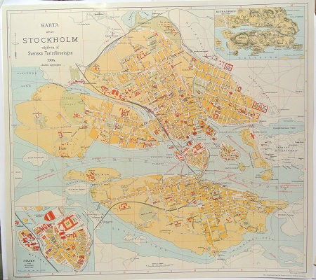
Karta öfver Stockholm. - 1904.

Grevskapet Lapplands vapen - Svecia Antiqua et Hodierna.
Olaus Magnus text till den berömda kartan "Carta Marina".
Texten finns även pĺ katalanska, spanska och engelska.
Bureus karta över norden
Kartor och atlaser
Bilder och planschverk
Teckenförklaringar
The old economic map
in the Region of Mälaren.
In connection with the enclose process (“laga skifte”) it was recommended
that a summary of the maps to generalized representation of whole parishes be
produced. This work was much furthered by the order that the parish maps could
serve as a sort of qualification works for surveyors. Summaries of the
enclosure maps were also put together as framework (“stomkartor”) both for
the topographic maps and for the economic maps that were drawn for "härad"
districts that consists of a group of parishes. The economic "härad"
maps were printed in the scale of 1:50 000 beginning with the maps of the
"härad" of Uppsala county (“län”) 1860. The economic maps of
Uppsala, Stockholm, Södermanland and Västmanland counties are here analyzed
as to their reliability as sources for geographical studies by means of a
comparison between the printed maps, the field maps (e.g. the revised "stomkartor")
and the underlying enclosure maps. The descriptions (“beskrivningar”)
belonging to the economic maps have been compared with official statistics
from the same years, if possible. As a result it can be said that the old
economic maps are well done and the field checking was very carefully
performed. Consequently the maps in question give a very fine synchronous view
of the regions. They should be more used by geographers, historians and
statisticians. Unfortunately all Sweden does not possess such maps.
