
BOUVET, JEAN BAPTISTE CHARLES DE LOZIER.
1705-86.
Fransk sjöofficer. 1738-39 ledde han en fransk expedition med fregatterna 'L'Aigle' och 'Marie' som skulle utforska omrĺdet vid Sydpolen. Pĺ 54:e breddgraden upptäckte han ett nytt land, 'Cap de la Circoncision', som han trodde var en del av Terra Australia. Det landet fick sedan namnet Bouvetön. Bouvet var den förste som seglade längs packisen och kunde berätta om de otaliga stora valar han sĺg i dessa farvattnen.
Agaard. - Nr. 80.
Svensk adlig ätt, som härstammar frĺn Jakob Hagman (se NORDENCREUTZ, JAKOB) och Filip Schultz (se NORDENCREUTZ, FILIP), hvilka 1719 samtidigt adlades med namnet N. och 1720 introducerades pĺ samma nummer. Den förre slöt själf sin ätt.
HASE [HASIUS, HASIUES, HAAS, HAASE, HASIO], JOHANN MATTHIAS [JOHANNES].
14 januari 1684 - 24 september 1742.
Tysk matematiker och geograf. Född och död i Augsburg (enligt vissa källor i Wittenberg). Studerade teologi och matematik, och fick 1707 en magistersgrad vid universitetet i Leipzig. 1720 professor i matematik i Wittenberg. Förutom matematik och astronomi kom han där att ägna sig mycket ĺt historisk geografi och kartografi. Bland hans större arbeten kan nämnas 'Historiae universalis politicae idea plane, etc.' (1742). Efter hans död utkom 'Atlas historicus comprehendens imperia maxima seu monarchias orbis antiqui' (1746-50). Hasius ritade ocksĺ en rad aktuella kartor varav de enkla specialkartorna över tyska provinser räknas bland de bästa inom sitt fack under 1700-talet. Verksamheten bidrog mycket till att frigöra tysk kartografi frĺn främmande inflytande. (Allg. d. Biogr.)
Hase gjorde flertalet kartor som gavs ut av Homans arvingar.
Als Sohn eines Lehrers der Mathematik lernte Hase zunächst an seinem Geburtsort am St.-Anna-Gymnasium und wurde schon früh von seinem Vater für die Mathematik begeiste...
Bland arbeten.
* Specimen algebrae ad artem fortificatoriam applicatae. Magisterarbeit, Leipzig 1707
* Sciagraphia integri tractatus de constructione mapparum omnis generis, geographicarum, hydrographicarum et astronomicarum et in specie de projectionibus sphaerarum imprimis stereographica. Leipzig 1717
* Dissertatio physico-mathematica de tubis stentoreis, in qua de figura & constructione exponitur earum et auctorum qui de eis egerunt, sententiae explicantur ac momento suo ponderantur. Leipzig 1719
* Dissertatio De Tubis Stentoreis, Earumqve Forma Et Structura, Fundamenta Ejus Praxeos Exhibens / Qvam D.F.G. Pro Loco In Fac. Phil. Lips. Obtinendo Postrema Vice Disputaturus Ad Diem XVIII. Mart. MDCCXIX. Leipzig 1719
* Pithometriae sive doliorum mensurae theoria nova algebrae ope eruta et perfecta. 2 Bände Wittenberg 1723
* Dissertatio academica de nihilo mathematico et formulis affinibus harumque in specie illis, quibus nihilo minores quantitates exprimuntur. Wittenberg 1727
* Dissertatio Mathematica De Pulchritudine Architectonica Prior. Wittenberg 1727
* Phosphorus historiarum, vel prodromus theatri summorum imperiorum : hoc est, historiae politicae universalis partis potioris et principalis, sistens recensionem, catalogos, vel si mavis, sciagraptiam, aut tabulas principum vel imperantium in illis imperiis, etiamque ... quis eisdem connexis, una cum enumeratione ditionum geographica. Leipzig 1728
* Laudatio funebris ..., Leichenrede auf Christiane Eberhardine von Brandenburg-Bayreuth, Wittenberg 1728
* De Quantitatis Et Unitatis Arithmeticae Vera Notione. Wittenberg 1732
* Disputatio Mathematica In Qua Doctrinam De Effectu Lentium Simplicium Tam Extra Oculum Quam In Oculo Ope Algebrae Expeditiorem Redditam Sub Praesidio ... Wittenberg 1735
* Africa Secundum legitimas Projectionis Stereographicae regulas et juxta recentissimas relationes et observationes in subsidium vocatis quoquo veterum Leonis Africani Nubiensis Geographi et aliorum monumentis et eliminatis fabulosis aliorum desiganationibus pro praesenti statu ejus aptius exhibita; Cum Privil. S. C. M. nec non S. R. M. Polon. et Elect. Sax. Nürnberg 1737
* Regni Davidici et Salomonaei descriptio geographica et historica. Nürnberg 1739
* Phosphorus Historiarum vel Prodromus theatri summorum imperiorum. Leipzig 1742
* De Magnitudine Comparata Et Determinata Urbium : Quae Propter Ipsam Mangnitudinem Celebres Habentur Potissimum In Antiquitate ... Consideratione Quorundam Operum Veterum Ex Magnificentissimis. 1739
* Evropa : in partes suas X Methodicas a primariis regnis denominata secundum divisa fidem recentissimarum observationum Mathematicarum et Historicarum , et exhibita secundum legitimas projectionis Stereographis leges = L'Evrope Divise'e en ses X Principales Parties, Cum Priv. Sac. Caes. Majest. Grat. / a Ioh. Matth. Hasio, I. M. Seeligmann sc. Nor., sculp., I. C. Reinsperger sculpsit. Nürnberg 1743
* Circvli Sveviae Mappa = Le Cercle de Svabe / ex subsidijs Michalianis delineata & a D.no I. M. Hasio M. P. P. quo ad accuratam singulorum Statuum determinationem emendata & ad L L. magis legitimae project reducta. Opus summi Geographi posthumum, & adjuncta Tabula explanatoria editum opera Homannianorum Heredum. Nürnberg 1743
* Karte von dem russischen Reich und der grossen so wohl als kleinen crimischen Tartarey : nebst dem Entwurff einer Erklärung darüber abgefasset und der unüberwindlichsten und großmächtigsten Kaiserin Anna decidirt Nürnberg 1738 „Historiae universalis politicae idea”. Nürnberg 1743, Nachdruck Stuttgart 1976
* Planiglobii terrestris mappa universalis. 1746
* Dvcatvs Silesiae Tabvla Altera Svperiorem Silesiam = La Haute Silesie, qui comprend les Principautes de Neise, de Munsterberg, de Iaegerndorf, de Troppau, d' Oppeln, de Ratibor, de Teschen; Cum Priv. Sac. Cćs. Maj. / exhibens ex mappa Hasiana majore desumta & excusa per Homannianos Heredes. Nürnberg 1746
* Circuli Sueviae 1748 Nachdruck Stuttgart 1989
* Dvcatvs Silesiae Tabvla Geographica Prima Inferiorem Eivs Partem, seu Novem Principatvs, quorum insignia hic adjecta sunt, secundum statum recentissimium complectens = La Basse Silesiae qui comprend les Principautes de Schweidnitz, de Iaer, de Glogau, de Breslau, die Liegnitz, de Brieg, de Wolau, de Oels & de Sagan / Ad mentem Hasiani avtographi majoris legitime delineata et edita curis Homann. Heredum. Nürnberg nach 1750
* Descriptio geographico-historica regni Davidici et Salomonei cum delineatione Syriae et Aegypti : juncta est urbium maximarum veterum et recentiorum comparatio, multis mappis geographicis et ichnographicis adornata Nürnberg 1754
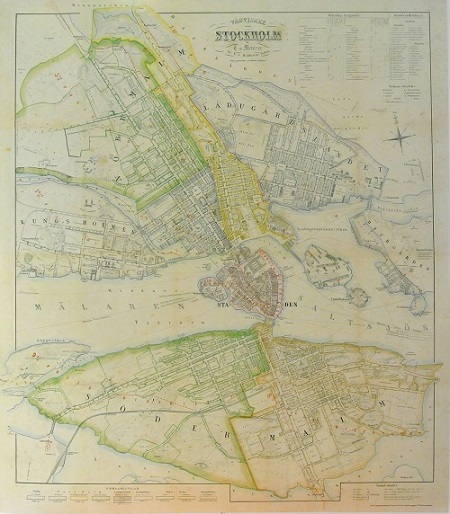
Stockholm - Mentzer ca 1860.

Pimpinellros, Rosa pimpinellifolia - Lindman, C. A. M, Bilder ur Nordens Flora 1917-26.
Olaus Magnus text till den berömda kartan "Carta Marina".
Texten finns även pĺ katalanska, spanska och engelska.
Bureus karta över norden
Kartor och atlaser
Bilder och planschverk
Teckenförklaringar
"Short notice about some Blaeu atlases."
Blaeu, Willem and Joan. Toonnel des Aerdrycks ofte Nieuwe Atlas (Atlas Novus). Amsterdam, 1635.
First Dutch Edition, 2 volumes, folio (505 x 330mm), half-title in volume 1, 2 engraved titles, 207 double-page engraved maps, title, maps, initial letters and tail-pieces all in finely coloured by hand, often heightened in gold, index at end of each volumes, seventeenth-century turkey leather, gilt, in vol. 1 the folding map of Lithuania torn and slightly browned, map 89 (Tractus Rheni et Mosae) past over earlier map, in vol. 2 map 19 (Bourgundien) pasted over earlier map, occasional marginal soiling, lacking ties, slightly bumped.
A fine example of this rare two-volume edition of the Blaeu’s Atlas Novus which over the next two decades was expanded into the monumental six volumes Theatrum. In February 1634, Willem Blaeu advertised his intention to publish a “groot Landcaertboeck de Atlas” in four languages: Latin, French, German and Dutch. The present Dutch printing was preceded the same year by the German edition and the Latin edition. All of the 1635 editions are now scarce.
References: Koeman I. Bl 9 & 10; van der Krogt 2: 121.
Ł 40000-60000
Blaeu, Johannes. Tooneel des Aerdrijcks ofte Nieuwe Atlas (Theatrum). Amsterdam 1649-1655.
6 volumes, folio (535 x 340mm). Dutch text, half title 1, 8 engraved titles and divisional titles (heightened in gold), 404 mostly double-page engraved maps coloured by hand, contemporary vellum gilt, volumes 2-6 with ties, some text leaves and mapsheets slightly browned, a few maps split at lower folds, some occasional worming (mainly in the margins).
This set forms the six-volume series known as the Theatrum Orbis Terrarum Which began publication in 1635.
The set collates as follows:
Volume 1, 2 parts in one volume (1649). World, Scandinavia, Germany and the Netherlands: 120 maps.
Volume 2, 2 parts in one volume (1650). France, Italy, Spain and the continents: 91 maps.
Volume 3 (1651). Italy and Greece: 62 maps, Some browning (particularly to the text) map of Greece partially hand-coloured.
Volume 4 (1658). England and Wales: 58 maps.
Volume 5 (1654). Scotland and Ireland: 55 maps.
Volume 6 (1655). China and Japan: 17 maps, marginal worming affecting engraved title and first map.
Ł 60000-80000
Blaeu, Johannes. Atlas maior, sive cosmographia Blaviana, qua solum, salum, coelum accuratissime describuntur. Amsterdam: Joannes Blaeu, 1665.
11 volumes, folio (540 x 340mm), engraved allegorical or architectural frontispieces, printed titles with engraved vignettes and divisional half-titles, 593 engraved maps and plates, mostly double-page (some folding), extra-illustrated with 28 engraved maps, engraved illustrations, coloured throughout in a contemporary hand, heightened in gold, eighteenth-century calf over boards, gilt double-filler border, gilt roll-tooled inner panel with fleurons at each inner corner, large gilt lozenge shaped centerpiece incorporating acanthus leaves and a central globe device, spine gilt in compartments, gilt lettered, gilt edges, each volume housed in custom-made slipcases.
This atlas collates as follows:
Volume I. World, Europe and Scandinavia. 61 maps and plates, extra illustrated with 2 maps by de Wit: “nova orbis tabula in lucem edita” between g2 and g3 of the Preliminary section and “nova et accurate totius Europae description” between a2 and b1 of the Europe section, lacking text leaf with “admonition de origine ducatus Slesvicensis”, Some light marginal staining.
Volume II. Northern and Eastern Europe. 39 maps and plates, extra illustrated with 8 maps: “novissima Russiae tabula” by I*saac Massa between A2 and B1 of the Russia section; Ukrainae pars quae Barclavia Palatinatus” (slightly stained), “Ukrainae pars quae Kiovia Palatinatus”, “Ukrainae pars quae Pokutia”, Ukrainae pars quae Podolia Palatinatus”, all by Guillaume Le Vasseur de Beauplan, between R1 and S1 of the Poland section; “Illyricum Hodiernum” by Blaeu between Q2 and R1 of the Souteastern Europe section; “exactissima Totius Archipelagi nec non Graeciae tabula” by Nicolas Visscher between A2 and B1 of the Greece section; “nova et accurate Moreae olim Peloponnesus dictae delineaatio” by Blaeu between G2 and H1 of the Greece section, lacking second letterpress title-page, lacking dedication to Czar Alexei, couple of small marginal holes (not affecting text) map of “Hungaria Regnum” slightly stained, several leaves browned.
Volume III. Germany. 96 maps ( 3 folding), extra illustrated with 8 maps; “circuli Austriaci pars septentrionalis” between F2 and G1, “regnum Bohemia” between I2 and K1 (upper right-hand corner creased), “circulus Bavaricus” between 2L2 and 2M1, “circuli Saxoniae superiori” between 2Q2 and 2R1, “marchionatus Brandenburgi et ducatus Pomeraniae” between 3D1 and 3E1, “circulus Saxoniae inferioris” between 3Q2 and 3R1, “Leodiensis episcopates” between 5R2 and 5R3, “utriusque Alsatiae ducatus Dupontii et Spirensis episcopates” between 7B1 and 7C1, all by de Wit save the penultimate map which is by Visscher, closed tear to lower margin of folding map of the Rhine, some offsetting from maps, browning to some leaves.
Volume IV. The Low Countries. 63 maps, extra illustrated with a map “Belgii regii tabula” by Visscher between f1 and A1, some light staining.
Volume V. England and Wales. 58 maps, extra illustrated with a map “Anglia regnum in omnes suous ducatus” by de Wit between V2 and X1, lacking 2V1 and 2 (two pages of text and a map of Surrey), replaced by an unsigned map of Surrey, verso blank.
Volume VI. Scotland and Ireland. 55 maps, light staining to some inner margins affecting a few maps.
Volume VII. France and Switzerland. 69 (of 70) maps, pp. 123 and 124 printed on separate sheets, map 50 in the rare state of having the signature 4L and some text on p. 209, lacking map 55 (“La Bresse Chalonnoise”), not called for in index and often not present, some browning.
Volume VIII. Italy. 60 maps, extra illustrated with 3 maps by de Wit; “accuratissima dominii Veneti in Italia” between 2A2 and 2B1, “staus ecclesiasticus et magnus ducatus Thoscanae” between 2V2 and 2X1, “regnum Neapolis” between 4C2 and 4D1, some browning.
Volume IX. part 1. Spain and Portugal. Part 2. Africa. 41 (28 + 13) maps and plates, including 3 folding, extra illustrated with 2 maps by Visscher; Hispaniae et Portugalliae regna” between a2 and b1, “Portugalliae et Algarbiae regna” between 2I2 and 2K1, map 1 (“regnorum Hispaniae nova description”) creased at centre, map 34 (“Nigritarum region”) with a repaired closed tear, map 40 (“insulae promontory viridis”) torn with corner loss (not affecting map).
Volume X. Asia. 28 maps, extra illustrated with 3 maps, “accuratissima totius Asiae tabula” between A2 and B1 and “nova Persia Armerniaae, Natoliae et Arabiae description” between D2 and E1, both by de Wit; “terra sancta” between L2 and M1 by Vissscher, some offsetting from maps, heavy spotting.
Volume XI. America. 23 maps, map 1 (“Americae nova tabula”) creased, map 17 (“sinus omnium Sanctorum”) loose.
This is a comparatively late issue of Blaeu’s incomparable masterwork, with 28 extra maps by Visscher, de Wit and others. Van der Krogt examined nine such copies (not including the present copy) as part of his survey of the Atlas Maior, with the number of extra maps ranging from 18 to 136.
The title cartouches provide the cartographer with a means to illuminate the peoples and fauna of the geographic locales depicted. So, a sinisterly smiling polar bear represents the Arctic, snooty camels Arabia, codfish Canada and scuttling armadillos Central America.
The Arlas Maior was a mammoth publishing undertaking and hugely expensive. Sets of the atlas were presented as diplomatic gifts by the Government of the Netherlands and special furniture to house it was produced, such as the lavish cabinet constructed for Prince Johan Willem Friso of Orange’s set. It is still widely regarded as the greatest atlas of them all.
References: van der Krogt 2:603.1C; 2:603.2B; 2:603.3C; 2:603.4; 2:603.5 (i.e. 2:303Y); 2:603.6 (i.e. 2:402Y); 2:603.7BA; 2:603.8B; 2:603.9A but with letterpress title-page of 2:731; 2:603.10A and 2:504; 2:601.11; Koeman I, BI 56; Sabin 5714.
Provenance: Baron de Karg, note on pastedown of volume 1 and signature on title-page of volume 2, probably Friedrich Karl Baron Karg von Bebenburg, the Lord of Reichstein-Schönsee from 1760 to 1797; Johann Adam von Reisach of Monheim (1765-1820), suicidal bibliophile, bought from the Bibliotheca Kargianae on May 1796, signature and “ex bibliotheca Reisachiorum” inscriptions in each volume, see S. Kramer, “Ex bibliotheca Reisachiorum”, Scriptorium 34 (1980), 91-95.
Ł 180000-240000
Blaeu, Johannes. Le Grand Atlas, o Cosmographie Blaviane [Atlas Major]. Amsterdam: Johannes Blaeu, 1667.
12 volumes, second French text edition, folio (525 x 335mm), 8 engraved frontispiece (none in vol. III, IV, VIII, X or XII; two in vol. XI), 13 printed titles with vignettes, 13 half-titles, and 596 engraved maps, plans, views and plates by Blaeus (mostly double-page) finly hand-coloured in a contemporary hand, original vellum brightly gilt with central arabesques, some occasional browning, more, XI and XII, some creasing, lacking several ties.
“The contents of this unprecedented atlas illustrate the high standards of contemporary cartography and geographical knowledge, and its presentation bears witness to the superb craftsmanship of engraver, printer, binder and papermaker…..The costly atlas was in fact exclusively designed for those members of the patriciate who could command both the material and intellectual resources that were needed to bay it and appreciate it” Koeman (1970), pp. 1-3.
Some 300 sets are believed to have been published, many which were presented throughout Europe as a tangible symbol of the Republic of the United Netherlands. The French text editions of 1663 and 1667 are, apart from minor text corrections, identical and are “literally the must voluminous of all editions.
This copy collates according to Van der Krogt 2:61 and consists of:
Volume I. World, Europe and Scandinavia: 61 maps and plates, including 5 plans and 9 plates of Tycho Brahe’s astronomical observatory on the island of Ven in the Danish Sound (after the woodcuts of Brahe’s Astronomia instauratae mechanica (Wandbseck, 1598)), where Johannes Blaeu’s father assistant and student for a time. The maps of Slesvig are part of the series originally published in Caspar Danckwerth and Johannes Mejer’s New Landesbeschriebung der zweij Herzogthümer Schleswig und Holstein, 1652. The world map which begins the atlas is the twin-hemispherical type introduced in the first edition of the Atlas major in 1662.
Volume II. Northern and Eastern Europe: 39 maps and plans, including plans of Moscow and the Kremlin.
Volume III. Germany: 96 maps, including the remainder of the Danckwerth and Mejer series collected in vol. I., General map of Germany with small hole, and 2 rust-holes in text.
Volume IV. Netherlands: 63 maps, including several from Sanderus Flandria illustrate (first published in 1641).
Volume V. England and Wales: 58 maps and 3 views. (Unusually the woodcuts and engraved vignettes depicting antiquities throughout the text are coloured).
Volume VI. Scotland and Ireland: 55 maps, chiefly after the surveys of Robert Gordon and Timothy Pont.
Volume VII. France: 36 maps.
Volume VIII. France and Switzerland: 36 maps.
Volume IX. Italy: 60 maps.
Volume X. Spain and Africa: 41 maps and plates, including the fine series of 7 plates showing plans and views of the Escorial in honour of Philip II.
Volume XI. Asia: 28 maps, including the 17 maps on China and Japan after Fr. Martino Martini.
Volume XII. America: 23 maps. The Brazilian maps, originally published by Blaeu in Barlaeus Rerum Octennium in Brasilia, 1647, show the fine vignettes after Frans Post, some light offsetting and light waterstaiing at outer edge.
References: Koeman 1, BL59; Van der Krogt 2:61.
Ł 150000–200000
