VÖBAM - Din källa till den äldre bild- och kartvärlden. - Tel: 08-102121 - Epost: info@vobam.se
Biografier.

SCHOTEN, FRANCIS van.


Prof. Mathematics at Leiden, cartographer.

Bland arbeten.
Bergen op Zoom, Blaeu 1630 etc. and Jansson (1636).


Tooley.


ÖSTERBERG, ERIC.

Född 1746 12/6 i Uppsala, död före 1779 i dec., trol. i Lovisa.
Akademigravör. Underofficer. Son av ullkammaren Carl Ö. och Brita Menlös. Elev av Anders Åkerman i Uppsala från 1759. Volontär vid Fortifikationen 1771. Överflyttade 1773 till Åbo, där han var verksam som akademigravör till 1777. 'Graveuren wid kongl. academien härstädes Eric Österberg har till allmänhetens och i synnerhet scholornes tjänst, i koppar stuckit en swensk och latinsk föreskrift, jämwähl alphabeterne, som med wacker stil och accuratesse äro förfärdigade, och säljes i partie för 2 dal. 26 öre, men styckewis för 5 dal. K:mt...' (Tidningar utgifne af et sällskap i Åbo 1776 29/2). Ö. begav sig 1777 till Lovisa, där han tog tjänst som underofficer vid ett värvat regemente.

Bland arbeten.
S. DURAEUS, De visu, diss., resp. J. Södervall, Uppsala 1765: schematisk framställning av ögat jämte geometriska figurer, kpst. Ö. graverade ett flertal geometriska figurer för matematiska dissertationer vid Åbo akademi och Uppsala universitet under presidium, av bl.a. M. J. ALOPAEUS, Åbo 1764-74, O. S. WETTERQUIST, Uppsala 1765, S. DUILEUS, Uppsala 1766, H. H.
WALLENBERG, Uppsala 1766, samt för A. PLANMAN, Åbo 1776.
Karta över Bornholm, efter T. Cöhler, 1765.
A. ÅKERMAN, Atlas juvenilis. 1:a uppl., Uppsala 1768: 16 kolor, kartblad över Europa; 2:a uppl., u. o. [1774]: 20 kolor. kartblad över Europa.
C.F. GEORGII, De insula Sela, Sudermanniae, diss., resp. E. Humbla, Uppsala 1771: karta över Selö i Mälaren.
DENS., De paroecia Braenkyrka toerneae meridionalis in Sudermannia, diss., I, resp. J. W. Brannius, Uppsala 1769: tab. med kufiska mynt, etsn.
J. IHRE, De runarum in Suecia antiquitate, diss., resp. U. von Troil, Uppsala 1769: tab. med 3 runstenar och runalfabet, etsn.
H. G. PORTHAN, Narratio R. V. Pauli Juusten episcopi Aboénsis de legatione sua russica, diss., I, resp. G. W. Rydman, Åbo 1775: vapensköld, etsn.
J. LINDELL, Cantilenae selectiores, Åbo 1776: titelblad, titel och vignett med lekande skolpojkar, inom rik rokokoram, efter G. P. Nordberg, kpst., samt 15 text-och notsidor, kpst.


BOTERO, GIOVANNI.

1533-1617. Född i Bene i Piedmont, död i Torino.
Italiensk präst och författare. Studerade vid jesuitkollegiet i Torino, 1576-84 sekreterare hos Carlo Borromeo och ärkebiskop av Milano. Kom i tjänst hos hertig Carl Emmanuel I av Savoyen, bl.a. som diplomat. Slutligen blev han abbot i 'San Michele delle Chiusa' i Piemont. Förutom sin 'Relationi universali' gav han ut en rad statsrättsliga och politiska skrifter. I politiskt hänseende var han en bestämd motståndare till Macchiavelli. Hans skrifter, som var författade på italienska, fick stor utbredning genom översättningar till andra språk.


Bland arbeten.
Relationi universali.


Encicl. Ital. - Th. und K.


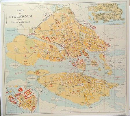
Karta öfver Stockholm. - 1904.


'Lotharingiae' - Johann Baptist Homann ca 1710.


Sök efter biografi:

Du sökte på: 10532

Klicka på valfri bokstav för att återgå till hela listan.  

A  B  C  D  E  F  G  H  I  J  K  L  M  N  O  P  Q  R  S  T  U  V  W  X  Y  Z  Å  Ä  Ö

Sophianos, Nikolaos.

Sophianos was well known as an expert on Greek history and geography. He was sent to Greece in about 1543 by Don Diego Hurtado de Mendoza, the Spanish envoy to Venice, to acquire Greek manuscripts for the Escurial Library. It is about this time – possibly in 1540, the date found at the end of Sophianos text on this map – that Sophianus compiled his great map of Greece, although there is no surviving example.
In 1544, Johann Oporinus, a printer and publisher in Basle, published an eight-sheet version of Sophianos map, cut by Master Christoph of Strasburg. Of this earliest printing, there is also no known extant example. Indeed, the earliest surviving printing of the map recorded by Zacharakis or Karrow was printed by Johann Schroeter in Basle in 1601.
It appears that Oporinus reprinted the map in 1545 to accompany his edition of Gerbelius “In Descriptionem Graeciae Sophiani, Praefatio….”. Although the book gives instructions on colouring the map, and contains additional gazetteer, the map seems not to have been routinely bound with the book, but rather was issued separately, hence its rarity.
Karrow records no example of the book with the map, however, an example in the Library of Congress is described as having the map(the British Library example does not), and this example almost certainly owes its survival, and fine condition, to having been bound in the book, as the page size is very similar to the BL example.
Karrow notes that Oporinus commissioned a series of town views to accompany the map. Visible along the lower border is the upper border of a frame where these views might have been placed, but this additional panel has been masked off in printing.
Bland arbeten:
Descriptio nova totivs Graeciae per Nicolavm Sophianvm. Basle, 1544-1545, large woodcut wall-map of Greece, on eight sheets uncut, each sheet approx. 380 x 280mm., with an additional sheet with letterpress gazetteer. Of great rarity. The earliest surviving wall-map of Greece and the first significant modern map of Greece, compiled by Nickolaos Sophianos, a Greek cartographer from Corfu, born of a noble family there. This example is apparently the second state of the map. It retains the date 1544 just above the scale bar on the bottom right hand skeet, but the letterpress text in the left hand cartouche on the lower left sheet may have been reset, in whole or part, as it ends with the date “prid[ie] Calend[is]. Septembr[is]. Anno salutis publiae M D X L V”.
(Sotheby's. Zacharakis, Printed Maps of Greece: Sophianos 2242; Karrow, Mapmakerers of the Sixteenth Century, 71/1.2.)

Tillbaka till början.