VÖBAM - Din källa till den äldre bild- och kartvärlden. - Tel: 08-102121 - Epost: info@vobam.se
Biografier.

STELLA [STOLZ, STOLTZ, SIGENIS], TIELEMANO.

1527-1589, d. Wittenberg.
His maps used by Ortelius, de Jode, Hondius, Blaeu.

Bland arbeten.
Totius Germaniae 1546.
Maps for Bible 1552-7.
Jerusalem 1557.
Revised Münster's Germany 1560.


Tooley.


JOHNSTON, Sir WILLIAM.

1802-88. Född och död i Kirkhill.
Skotsk kartograf, bror till JOHNSTON, ALEXANDER KEITH. Efter sin lärotid som kartgravör etablerade han 1826 tillsammans med sin bror det ansedda kartförlaget W. & A. K. Johnston i Edinburgh. William Johnston hade under årens lopp en rad olika offentliga förtroendeuppdrag. Bla. var han under några år borgmästare i Edinburgh. 1867 drog han sig tillbaka från företaget.


Dict. nat. biogr.


LJUNGGREN, SAMUEL GUSTAF.

Född 1759 23/8 på Huvudsta i S:t Pers sn (Sthlm), död 1836 5/9 på Katrinelund i Lindesbergs sn (Ör.).
Lantmätare. Gravör. Son av kronobefallningsmannen Samuel Johan L, och Ingrid Margareta Vallberg. Student vid Uppsala universitet 1777. Avlade lantmäteriexamen 1783. Förste lantmätare i Örebro län 1802-34.
Bland arbeten.
Karta över Porla källa, 1815.


Hultmark, 1944.


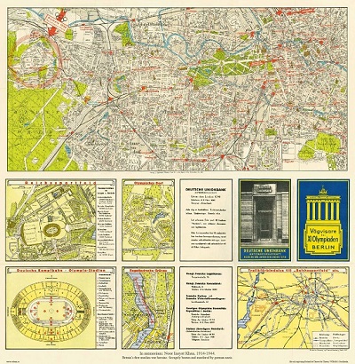
Vägvisare för XI Olympiaden i Berlin - 1936


Bogesund - Nay 1881.


Sök efter biografi:

Du sökte på: 10429

Klicka på valfri bokstav för att återgå till hela listan.  

A  B  C  D  E  F  G  H  I  J  K  L  M  N  O  P  Q  R  S  T  U  V  W  X  Y  Z  Å  Ä  Ö

WAGHENAER, LUCAS JANSZOON.

Holländsk kartograf i slutet av 1500-talet. Efter att ha vunnit ett rykte som erfaren skeppare och lots började han som den förste i världen med att ge ut en sjökartsatlas. Den kom ut 1584-85 under titeln 'Spiegel der Zee-Vaerdt'. Den kom senare i en rad utgåvor på olika språk. 1592 följdes den av 'Tresoor der Zee-Vaert'. Dessa två verk var epokgörande inom sjökartografins område och namnet 'Waghenaer' var under en lång tid synonymt med bra sjökort. Han gav även ut en översiktsplan och en karta över sin hemstad Enkhuysen.

By the third quarter of the sixteenth century an ever increasing volume of the wealth of the New World and the Indies was reaching Lisbon and the Spanish ports, there to be trans-shipped to Northern and Western Europe. This trade was almost entirely in the hands of the Dutch so it was logical that one of their pilots should produce the first set of effective navigational charts. These were compiled under the title Spiegel der Zeevaerdt, by Lucas Janszoon Waghenaer, a native of Enkhuizen on the Zuider Zee, an experienced seaman and pilot. His magnificently produced charts embodying all the latest contemporary knowledge of navigation and position-finding set a standard which was followed by others for the next century or more -indeed, some of the symbols employed are still in use today. The charts in the first edition, covering the coast lines from Holland to Spain and the North Sea and Baltic, were engraved by the van Doetecum brothers and printed by Plantin: those in the English edition, which was translated by Sir Anthony Ashley and issued in 1588 - the year of the Armada - were engraved by de Bry, Hondius, Rutlinger and Ryther, who also engraved some of Saxton's maps. The charts are extremely picturesque with elaborate cartouches, ships in full sail and the sea monsters so commonly used as decoration in maps of the period. Place names are given on the coasts but comparatively few are shown inland; cliffs on the coastline are drawn in elevation; navigational landmarks and hazards, anchorages, soundings and tidal details are indicated and the scale is shown in English, Spanish and Dutch leagues. Altogether some of the most handsome maps ever produced.
The charts became so universally popular that their name, anglicized to 'Waggoner', came into use in English as a generic term for sea charts of all kinds.
Bland arbeten:
Spiegel der Zee-Vaerdt.
Tresoor der Zee-Vaert.
(Nederl. biogr. - Nissen. - Phillips.)

Tillbaka till början.