VÖBAM - Din källa till den äldre bild- och kartvärlden. - Tel: 08-102121 - Epost: info@vobam.se
Biografier.

GIGAS [GIGANTE, GIGUS] JOANNES [IOANNE] MICHAEL.

1580-1650+.
Doctor, mathematician and geographer.

Bland arbeten.
Atlas of Archbishopric of Cologne 1620 (maps used later by Blaeu & Hondius), Paderborn, J. Hondius (pre-1629), Osnabrug, Westphalia, Munster, Hildesheim – all n.d.


Tooley.


NICOLAUS GERMANUS.


Often called 'Donis' from a misapprehension of the title 'Donnus' or 'Donus' an abbreviated form of 'Dominus.
A fifteenth-century cartographer, place of birth, and date of birth and death unknown. The first allusion to him of authentic date is an injunction of Duke Borso d'Este (15 March, 1466) to his referendary and privy counselor, Ludovico Casella, at Ferrara, to have the 'Cosmographia of Don Nicolò' thoroughly examined and then to determine a recompense for it. The duke, on the thirtieth of the same month, called upon his treasurers for 100 florins in gold 'to remit as a mark of his appreciation to Donnus Nicolaus Germanus for his excellent book entitled 'Cosmographia''. On 8 April, 1466, the duke again drew thirty golden florins to present to the Rev. Nicolaus, who 'in addition to that excellent Cosmography' (ultra illud excellens Cosmographie opus) had dedicated to the duke a calendar made to cover many years to come ('librum tacuini multorum annorum'). The 'Cosmographia' as preserved in the Biblioth
...


FISCHER, Nicolaus Germanus in Entdeckungen der Normannen in Amerika (Freiburg, 1902), 75-90, 113 sqq. (Eng. tr., London, 1903), 72-86, 108 sqq.


Verbiest, Pieter.

1607-74.
An engraver and publisher active in Antwerp who produced a small number of maps including one of the British Isles based on an earlier map by N. Visscher.


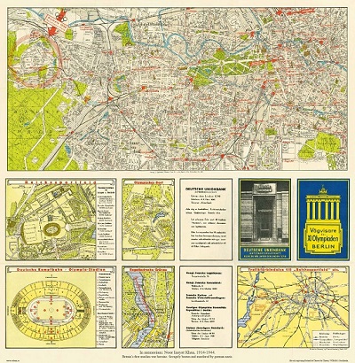
Vägvisare för XI Olympiaden i Berlin - 1936


Vitklöver, Trifolium repens - Lindman, C. A. M, Bilder ur Nordens Flora 1917-26.


Sök efter biografi:

Du sökte på: 10022

Klicka på valfri bokstav för att återgå till hela listan.  

A  B  C  D  E  F  G  H  I  J  K  L  M  N  O  P  Q  R  S  T  U  V  W  X  Y  Z  Å  Ä  Ö

BARENTS, WILLEM.

Biografiska uppgifter:Död 1597.
Holländsk sjöfarare som ledde flera expeditioner för att finna en nordlig sjöförbindelse med Kina (Nordostpassagen). Sommaren 1594 nådde han Novaja Semljas västkust och följde denna norrut till 77:e breddgraden. Ett annat skepp i expeditionen seglade genom Vaigatsjstredet och hittade isfritt hav vidare längs nordkusten av Asien. En ny expedition året efter hittade emellertid denna passage blockerad av packis och tvingades vända. På sin tredje expedition 1596 hittade Barents Björnön och upptäckte Svalbard som inte tidigare varit känt sedan vikingarnas resor dit. Från Svalbard fortsatte han till Novaja Semlja och seglade runt nordspetsen av ön, där expeditionen blev den första att övervintra i Norra Ishavet. Då skeppen följande vår inte kom loss från isen tvingades manskapet överge dessa och färdas vidare i öppna båtar. Efter stora ansträngningar nådde de flesta fram till Lappland där de blev räddade, men Barents själv och flera andra omkom under resan.

Barentsz was a noted pilot who was convinced by the theorists of the day that it was possible to reach China and India via a North East passage through the Arctic. On his first voyage in 1594 accompanied by Jan van Linschoten he reached Novaya Zemlya but was forced back by ice: he failed again the following year. On his third voyage in 1596-97 his ship was trapped in pack ice and, although many of his crew survived in open boats, Barentsz himself died on the return voyage. He is noted for this chart book of the Mediterranean, the first of its kind, which was complementary to Waghenaer's charts of the Atlantic coasts, and which is sometimes found bound up with the later editions of Waghenaer.
(Salmonsen.)

Tillbaka till början.